The Ghost City Beneath the Canopy: How Lidar Woke Up the Sleeping Giant
By Sam Guss
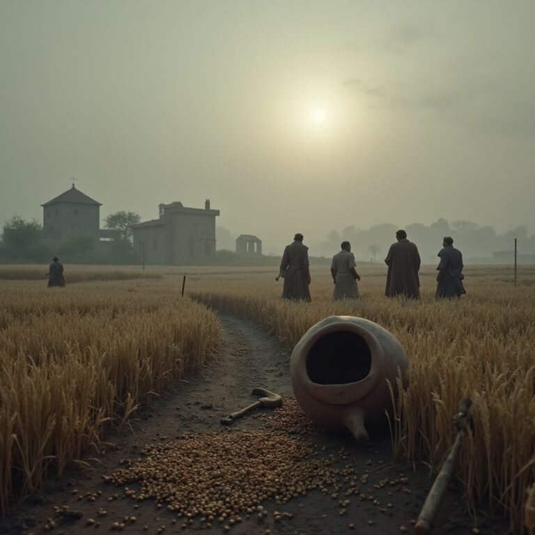
We have a romantic hallucination about the jungle. We imagine it as the “Pristine Wilderness.” We see the dense green canopy of the Yucatán or the Amazon as a place where nature reigns supreme, untouched by the hand of man. When we imagine an archaeologist, we imagine a rugged figure with a machete, hacking through the vines, stumbling upon a lost temple covered in moss.
But this image is a lie. The jungle is not a wilderness. It is a camouflage net.
And the archaeologist of 2026 isn’t hacking through vines with steel. They are stripping away the forest with light.
In late 2024, a discovery was published in the journal Antiquity that fundamentally broke our understanding of the Maya civilization. It wasn’t found by an expeditionary force. It was found by a PhD student sitting at a computer terminal, staring at a screen.
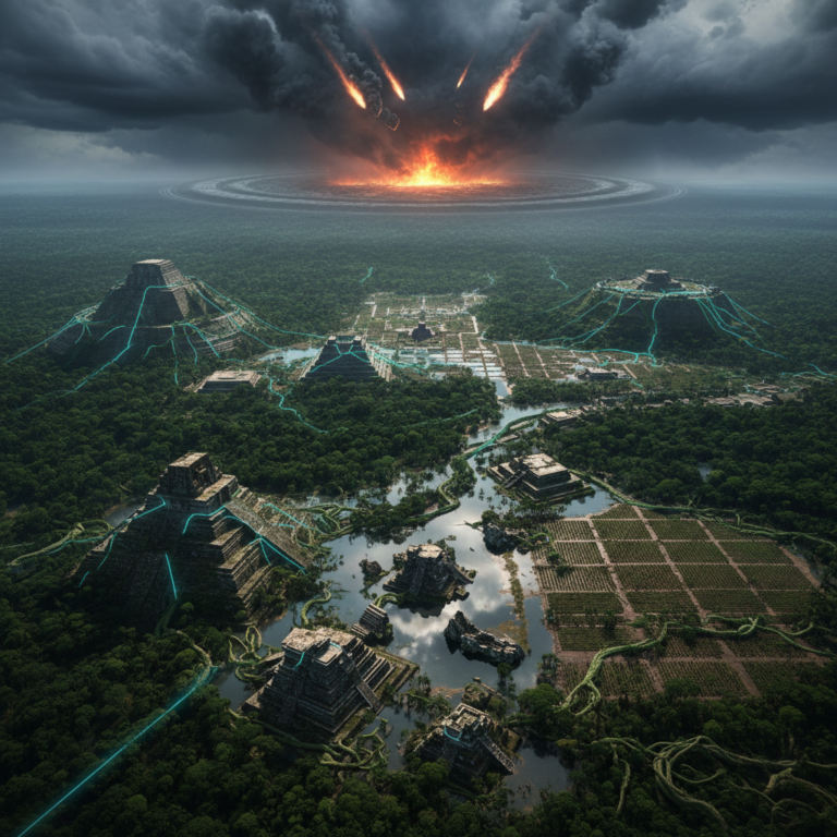
He found a megalopolis. He found a city with the density of Tikal and the complexity of Teotihuacan, hiding in plain sight.
Its name is Valeriana. And for the last thousand years, people have been walking on top of it, farming on top of it, and driving on top of it, without ever knowing that a ghost empire lay just beneath their feet.
I. The Myth of the Empty Map
To understand the shock of Valeriana, you have to understand the “Map of Ignorance” we have been operating on.
For a century, Mayan archaeology focused on the “Big Stars”: Chichén Itzá, Tikal, Palenque. These were the massive stone capitals that poked through the trees. We assumed that between these cities lay vast stretches of empty jungle—sparsely populated hinterlands where jaguars roamed and peasants lived in perishable huts.
We assumed the Maya were a civilization of “City-States” separated by wilderness.
But Lidar (Light Detection and Ranging) has destroyed that assumption. Lidar works by firing billions of laser pulses from an aircraft toward the ground. Some pulses hit the leaves; some hit the dirt. By filtering out the “vegetation” layer in the software, you are left with a “Digital Terrain Model”—a naked map of the earth.
When you strip the trees, the “wilderness” vanishes.
What appears instead is a Super-Grid.
II. The Accidental Discovery: Archaeology via Recycling
The discovery of Valeriana is a perfect “Techno-Mystic” parable because it wasn’t intentional. It was a data glitch.
Luke Auld-Thomas, a researcher at Northern Arizona University (and later Tulane), wasn’t looking for lost cities. He was looking at data sets. Specifically, he was browsing a Lidar survey commissioned by a nature conservancy group in 2013 to monitor forest biomass (carbon mapping) in Campeche, Mexico.
The ecologists who flew the plane were counting trees. They weren’t looking for pyramids. So, for ten years, the data sat on a server, ignored by archaeologists.
Auld-Thomas decided to process this “ecological” data through an archaeological filter. He adjusted the algorithms to look for sharp angles, geometric mounds, and unnatural leveling.
The screen lit up.
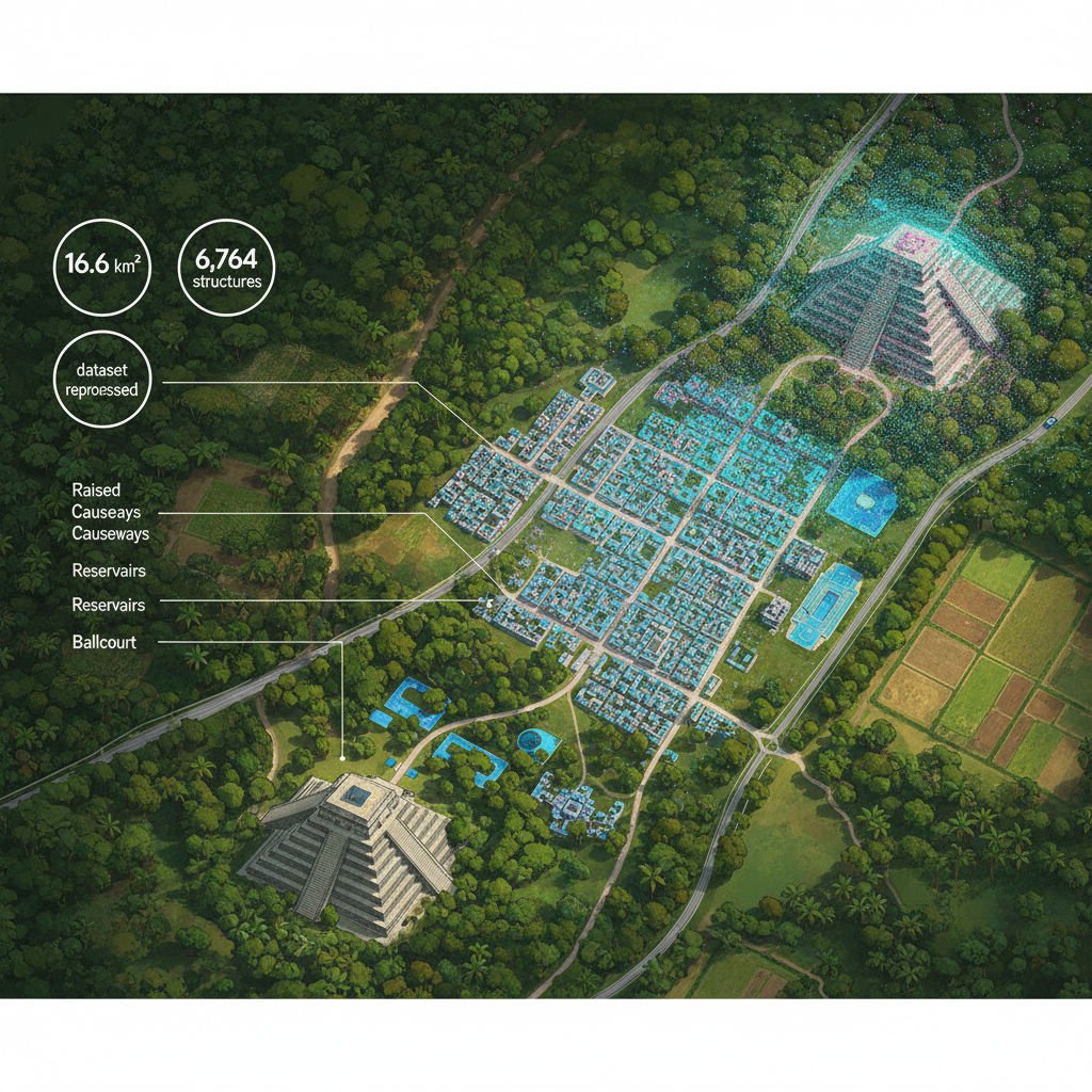
The data revealed a dense, urban landscape covering 16.6 square kilometers. It wasn’t just a few huts. It was a sprawling city with two major monumental centers, connected by causeways, reservoirs, and ballcourts.
He counted 6,764 structures.
This wasn’t a village. This was a metropolis. It was located right next to the modern highway near Xpujil. Modern farmers were planting corn on top of ancient residential platforms, thinking they were just natural hills. The modern world had literally paved over the ancient one, completely oblivious to the sleeping giant beneath the asphalt.
III. The Hardware: The “Continuous Urbanism”
The discovery of Valeriana forces us to introduce a new concept: Continuous Urbanism.
We are used to the European model of “City vs. Countryside.” You have London (density), and then you have fields (empty).
The Maya didn’t build like that. They built like modern Los Angeles or Tokyo. They built a “Sprawl.”
The Lidar scan of Valeriana shows a landscape that is almost entirely engineered. Every hill was terraced. Every depression was turned into a reservoir. The spaces between the “downtown” pyramid clusters were filled with suburban housing, workshops, and agricultural grids.
It suggests that if you walked from Valeriana to the next city (Becan or Calakmul) in 750 AD, you wouldn’t be walking through a “jungle.” You would be walking through a continuous, manicured garden-city. You would pass house after house, farm after farm, temple after temple.
It would have been loud. It would have smelled of woodsmoke, copal incense, and humanity.
This creates a cognitive dissonance. We look at the Yucatan today and see a “Green Void.” But in the 8th Century, this region might have been one of the most densely populated places on Earth. The “Wilderness” is actually a Feral Garden. It is what happens when a city is abandoned for 1,100 years and the landscaping crew stops showing up.
IV. The Mechanism: Hydro-Engineering the Karst
How did they support this density?
The Campeche region is a Karst landscape. It is porous limestone. There are no surface rivers. When it rains, the water vanishes underground immediately. In the dry season, it is a desert.
To build a city like Valeriana, you need to hack the hydrology.
The Lidar reveals the “Mechanism” of their survival. The city is engineered to act as a massive funnel. The plazas and causeways (sacbeob) were graded to direct rainwater into massive, plaster-lined reservoirs (aguadas).
They turned their architecture into a water-catchment machine.
But it goes deeper. The “bajo” (low-lying swampy areas) around the city were not avoided. They were modified. The Maya dug canals and raised fields in the swamps, practicing intensive wetland agriculture.
They didn’t just inhabit the land; they Terraformed it. They converted a hostile, water-starved limestone shelf into a breadbasket (or rather, a maize-basket) capable of feeding tens of thousands of people.
This was a “Hydraulic Empire.” Their power didn’t just come from religion or war; it came from the ability to guarantee water during the four-month drought. The King wasn’t just a priest; he was the Chief Engineer.
V. The Techno-Mystic Take: The Data was Always There
Why does Valeriana matter to the Techno-Mystic?
Because it proves that Discovery is a function of the Lens, not the Territory.
The city of Valeriana didn’t “appear” in 2024. It was always there. The farmers knew there were “strange hills.” The highway engineers probably hit stone when they laid the asphalt. The data itself had been sitting on a hard drive since 2013.
We couldn’t see it because we weren’t looking with the right eyes.
We used to need Indiana Jones to find history. Now, we need a Data Scientist.
This suggests a haunting possibility: What else is already on the server?
We have petabytes of satellite imagery, seismic data, and Lidar scans of the Earth that have only been analyzed for one specific purpose (oil exploration, weather, carbon tracking). If we ran an AI trained to spot “anomalous geometry” over the global archives of the oil industry, what would we find?
Atlantis? The erratic blocks of a pre-Ice Age civilization? The outlines of cities under the Sahara?
Valeriana teaches us that the “Unknown” is often hiding inside the “Known.” The ghost is in the machine, waiting for someone to change the search parameters.
VI. Conclusion: We Are the Next Layer
There is a final, somber reflection in the Lidar images of Valeriana.
You see the outline of a massive temple complex. And cutting straight through it, like a scar, is a straight line. That line is the modern Federal Highway 186.
We drive our trucks and our sedans over the bones of their kings. We put a gas station on top of their observatory.
We think our civilization is permanent. We think our concrete is forever. But the Maya thought their limestone was forever too.
The jungle didn’t destroy Valeriana; it just swallowed it. It wrapped it in a green embrace and waited. One day, a future archaeologist—perhaps an AI, or a post-human entity—will fly a sensor over the ruins of New York or Houston. They will strip away the “New Wilderness” (whatever that looks like) and see our grid.
They will see our “Continuous Urbanism.” They will see how we engineered the water and the soil. And they will wonder why we vanished.
Valeriana is a memento mori. It reminds us that “Civilization” is just a temporary clearing in the forest. If you stop cutting the grass, the forest comes back.
The grid is fragile. The jungle is patient.
References & Further Reading:
- Auld-Thomas, L., et al. (2024/2025). “Running out of empty space: environmental lidar and the crowded ancient landscape of Campeche.” Antiquity. Link to Journal
- BBC News (2024). “Huge lost Mayan city found in Mexico jungle by accident.”
- National Geographic. “Lidar reveals the secrets of the Maya.” (Context on previous Lidar breakthroughs).
- Canuto, M. A., et al. (2018). “Ancient lowland Maya complexity as revealed by airborne laser scanning of northern Guatemala.” Science. (The foundational 2018 study).
- Scott, J. C. Against the Grain. (Context on early state formation and landscape modification).